The Basic (or BASIC) programming language has gone through many incarnations. Today various forms of this Basic programming language are still active, such as VB6, qBasic, VBA, VBScript and VB.Net.
BASIC is a family of general-purpose, high-level programming languages whose design philosophy emphasizes ease of use; the name is an acronym from Beginner’s All-purpose Symbolic Instruction Code.
The original Dartmouth BASIC was designed in 1964 by John George Kemeny and Thomas Eugene Kurtz at Dartmouth College in New Hampshire, USA to provide computer access to non-science students. At the time, nearly all use of computers required writing custom software, which was something only scientists and mathematicians tended to do. The language and its variants became widespread on microcomputers in the late 1970s and 1980s, when it was typically a standard feature, and often part of the firmware of the machine. The presence of an easy-to-learn language such as BASIC on these early personal computers allowed small business owners to develop their own custom application software, leading to widespread use of these computers in businesses that previously did not have access to computing technology.
BASIC remains popular in numerous dialects and new languages influenced by BASIC such as Microsoft Visual Basic. In 2006, 59% of developers for the .NET Framework used Visual Basic .NET as their only programming language.[1]
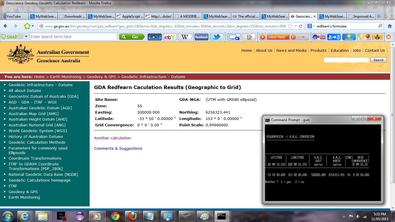
The tutorial shows one of these older forms of BASIC called GW-BASIC used to perform some Land Surveying calculation task.
Let’s see some simple GW-BASIC in action for a Latitude/Longitude to Geodetic Co-ordinate (Australian Map Grid) conversion program …
Link to Basic information … from Wikipedia from which quote above comes.
Link to Redfearn’s Formulae link … used in this program’s code.
Link to some downloadable GW-BASIC code … rename to Geoamg.bas.
It’s Ba-sic in the Sick-Bay … for those times when there’s a difficult Maths exam.
If this was interesting you may be interested in this too.


