छत्तीसगढ़
 Seal |

Location of Chhattisgarh (marked in red) in India

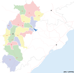
Map of Chhattisgarh
| Chhattisgarh छत्तीसगढ़ |
||
|---|---|---|
| State of India | ||
|
||
 Location of Chhattisgarh (marked in red) in India |
||
 Map of Chhattisgarh |
||
| Coordinates (Raipur): 21°16′N 81°36′E / 21.27°N 81.60°ECoordinates: 21°16′N 81°36′E / 21.27°N 81.60°E | ||
| Country | ||
| Established | 1 November 2000 | |
| Capital | Raipur | |
| Largest city | Raipur | |
| Districts | 27 (9 dist. new) | |
| Government | ||
| • Governor | Balramji Das Tandon | |
| • Chief Minister | Raman Singh (BJP) | |
| • Legislature | Unicameral (90 seats) | |
| • Parliamentary constituency | 11 (year 2010) | |
| • High Court | Chhattisgarh High Court | |
| Area | ||
| • Total | 135,194.5 km2 (52,198.9 sq mi) | |
| Area rank | 10 | |
| Population (2011) | ||
| • Total | 25,545,198 | |
| • Rank | 16th | |
| • Density | 190/km2 (490/sq mi) | |
| Time zone | IST (UTC+05:30) | |
| ISO 3166 code | IN-CT | |
| HDI | ||
| HDI rank | 23rd (2005) | |
| Literacy | 71.04% (23rd) | |
| Official languages | Hindi, Chhattisgarhi | |
| Website | chhattisgarh.nic.in | |
| Symbols of Chhattisgarh | ||
| Language | Chhattisgarhi (a dialect of Hindi) | |
| Animal | Van Bhainsa (Wild Buffalo) | |
| Bird | Pahari Myna (Hill Myna) | |
| Tree | Sal or Sarai | |
Chhattisgarh (Chattīsgaṛh pronounced [tʃʰʌttiːsɡʌɽʱ]) is a state in Central India. It is the 10th largest state in India, with an area of 135,190 km2 (52,200 sq mi). With a population of 25.5 million, Chhattisgarh is the 16th most-populated state of the nation. It is a source of electricity and steel for India.[1] Chhattisgarh accounts for 15% of the total steel produced in the country. Chhattisgarh is one of the fastest-developing states in India.[2]
The state was formed on 1 November 2000 by partitioning 16 Chhattisgarhi-speaking southeastern districts of Madhya Pradesh.[3][4] Raipur was made its capital city. Chhattisgarh borders the states of Madhya Pradesh in the northwest, Maharastra in the southwest Telangana and Andhra Pradesh[5][6][7] in the south, Odisha in the east, Jharkhand in the northeast and Uttar Pradesh in the north. Currently the state comprises 27 districts.